

BY PC Bureau
September 8, 2026: India’s support for a United Nations initiative to make world maps more geographically accurate has triggered an unexpected cartographic controversy, with a UN map depicting Arunachal Pradesh and Aksai Chin between separate Indian and Chinese claim lines.
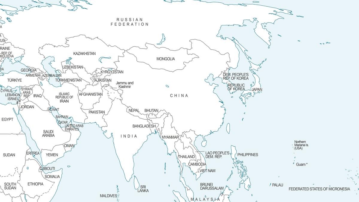
The map, published during the UN’s consideration of the resolution titled “Correct the Map: Rebalancing Global Cartographic Representation and Promoting Equitable Representation of the World’s Regions, Particularly Africa,” has drawn attention in India because of how it represents two of the country’s most sensitive territorial disputes with China.
The UN General Assembly adopted the resolution on September 4 by 164 votes to one, with six abstentions. India voted in favour. The initiative, led by Togo on behalf of the African Group and backed by the African Union, seeks greater use of equal-area projections to correct the distortion of the relative size of continents, particularly Africa.
But India’s vote did not amount to acceptance of any particular map or boundary depiction.
In its explanation of vote, India’s Permanent Mission to the UN made clear that New Delhi supported the broader principle of equal-area cartography, not the adoption of the Equal Earth projection or any specific representation of national boundaries.
The disputed UN cartography has nevertheless raised questions over the treatment of India’s territorial claims.
READ: Fake PMO ID, Gun: Two Detained at PM Modi Event Venue
Arunachal, Aksai Chin shown as disputed spaces
In the map dated July 1, Arunachal Pradesh is depicted as a distinct area between Indian and Chinese claim lines, rather than simply within India’s internationally claimed boundary. The depiction also does not show Arunachal’s boundary with Nagaland in the manner used on India’s official maps.
Aksai Chin, which India regards as part of Ladakh, is similarly presented between separate Indian and Chinese lines.
The treatment is particularly sensitive because China claims Arunachal Pradesh as “Zangnan” and has repeatedly rejected India’s territorial claim over the region, while India maintains that Arunachal Pradesh is an integral part of the country.
Aksai Chin, meanwhile, has been under Chinese control since the 1962 India-China war but remains claimed by India as part of Ladakh.
The same UN map uses a dotted Line of Control for Jammu and Kashmir and carries a note stating that the line represents approximately the LoC agreed upon by India and Pakistan and that the final status of Jammu and Kashmir remains unresolved.
No comparable explanatory note appears alongside the depictions of Arunachal Pradesh and Aksai Chin.
Delhi draws a red line
India has responded by making clear that its vote on the UN resolution should not be interpreted as acceptance of cartographic representations inconsistent with its official position.
MEA spokesperson Randhir Jaiswal said India’s sovereign territory, including the Union Territories of Jammu and Kashmir and Ladakh, must be shown according to India’s official map. He said any inaccurate or misleading depiction was unacceptable and reiterated that India’s position on sovereignty and territorial integrity was “clear, consistent, and non-negotiable.”
The Indian position also covers Aksai Chin, which New Delhi considers part of Ladakh, as well as Arunachal Pradesh.
At the same time, the UN resolution itself contains language making clear that it is not intended to alter sovereignty, territorial status or internationally recognised boundaries. During the General Assembly debate, Togo specifically stated that nothing in the resolution should be interpreted as modifying or affecting internationally recognised boundaries.
The resolution is therefore not a UN decision on the India-China border. Its principal purpose is cartographic: encouraging the use of projections that better represent the relative size of the world’s regions.
But the episode illustrates the diplomatic sensitivity surrounding maps. A cartographic line that may appear technical can carry significant political meaning when it concerns territory claimed by two major powers.
For India, the message is clear: support for correcting the world’s geographical distortions does not extend to accepting a map that, in New Delhi’s view, misrepresents India’s sovereign territory.