


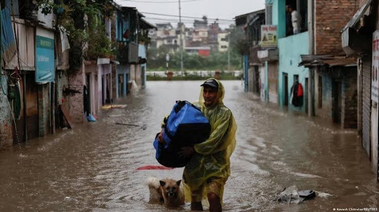
Before-and-after satellite images reveal the scale of destruction, while Nepal’s disaster authority describes the event as a “glacier-inclusive flood”. The region suffered a similar glacial flood last year.
BY PC Bureau
August 27, 2026: Fresh satellite imagery has provided a clearer picture of what may have triggered the catastrophic flash floods that devastated northern Nepal, pointing to an ice-and-rock landslide near a glacier zone as the likely cause.
Imagery from Planet Labs, analysed by Nepal’s National Disaster Risk Reduction and Management Authority, indicates that a massive landslide occurred about 20 kilometres northeast of the Rasuwagadhi Nepal-China border crossing. A huge mass of snow, ice and rock appears to have broken away near a glacial area, either crashing into a glacial lake or temporarily blocking the Lhende Khola river.
Glacial Lake Outburst Floods (GLOFs) occur when natural moraine or ice dams containing glacial meltwater fail. Rising global temperatures accelerate glacier retreat across the Hindu Kush Himalaya, expanding proglacial lakes and increasing hydrostatic pressure.
The recent… pic.twitter.com/w3BZ9C3sVw— Dr. PM Dhakate (@paragenetics) August 26, 2026
The sudden release of water and debris then generated a powerful surge carrying glacial ice, meltwater, mud and rocks downstream into the Bhote Koshi river. Nepal’s disaster authorities have described the event as a “glacier-inclusive flood.”
The flash flood struck at around 9 a.m. on Wednesday, sweeping through settlements and destroying roads, bridges and hydropower project sites along the Nepal-Tibet border. At least 157 people have been confirmed dead, while hundreds remain missing.
A significant number of those missing are Indian nationals. Early reports have put the number of missing Indians between 108 and 133, with Nepalese tourism officials saying many were pilgrims travelling towards Mount Kailash.
READ: 157 Killed in Nepal Floods ; 133 Indian Kailash Mansarovar Pilgrims Missing
Satellite images captured on August 25 and 26 provide a stark before-and-after comparison, showing the dramatic transformation of the affected landscape and the extensive destruction caused by the floodwaters.
The disaster has prompted an immediate response from India. Prime Minister Narendra Modi spoke with his Nepali counterpart Balendra Shah and offered full humanitarian assistance, while Indian teams are coordinating with Nepalese authorities in rescue and relief operations.
The latest disaster also highlights the vulnerability of the region to glacial hazards. The same stretch of the Nepal-China border was hit by a glacial-lake outburst flood in August last year, killing nine people and damaging vital infrastructure, including a bridge connecting Nepal and China.
Experts say the incident underscores the growing risks faced by communities and infrastructure in the Himalayan border region, where unstable slopes, rapidly changing glaciers and glacial lakes can combine to produce sudden and highly destructive floods. The remoteness of the affected area also makes early warning, evacuation and rescue operations particularly difficult.
Authorities are now examining satellite data and ground-level evidence to determine the exact sequence of events and assess the risk of further landslides or glacial flooding. The findings could help Nepal and China strengthen monitoring and early-warning systems in the vulnerable Himalayan valleys, particularly around settlements and major infrastructure projects.